Home
| Mt. Massive 14,421' |
| Torreys Peak 14,267' |
| Grays Peak 14,270' |
| Mt. Bierstadt - 14,060' |
| Pikes Peak -14,110' |
| Mt. Democrat, 14,118' |
| Mt. Cameron, Mt. Lincoln and Mt. Bross |
| Mt. Quandary - 14,265' |
| Mt. Yale, 14,196' |
| Mt. Evans 14,264' |
| Crestone Needle, 14,197' |
| LaPlata Peak, 14,336 |
 |
 |  |  |
|
Date Climbed: July 22, 2001
Route: Guanella Pass Trailhead
Estimated Miles: 6
Elevation Gain: 2,770
My Rating and Difficulty Level: Easy Moderate. Highly recommended for first timers!
Directions to Trailhead: Take the Georgetown exit off of Interstate 70. Drive through Georgetown and follow the signs for the Guanella Pass scenic byway. You must drive through the heart of Georgetown. Drive up 12 miles to the parking area at Guanella Pass (11,700'). The trail starts on the east side of the road in the parking lot - look for the trailhead sign.
|
|
|
|
We went against the grain and got a late start. Our hike began at 10:00. As all climbers know, its best to begin your ascent as early as possible so your chances of becoming one of Colorados lightning statistics are greatly decreased. With most mountains that I have climbed most individuals, follow this rule. However, Bierstadt seemed to be an exception for some reason. As we began our late start, hoards of other ambitious climbers were making their way through the crowded parking lot to the trailhead. If youre looking for solitude, regardless of when you start, Bierstadt in the summer is not the place to seek such a luxury. Luckily the beauty of the mountain and the surrounding peaks make up for the fact people are all over.
The hike begins at a well marked (by signage and by people present) Guanella Pass Trailhead on the east side of the road in both parking lots. The most favorable type of climb, in my opinion, is one that is quite intense throughout, with the most difficult sections in the beginning and at the very end before you are rewarded with your most excellent view. With Bierstadt, you descend first for approximately 1 mile at 11,400. You meander your way over a nice, rather long footbridge with Scott Gomer Creek running along side of you and crossing the trail itself in certain sections.
The Peak is in full view and beckoning throughout the entire approach. The section following next is known as the infamous willows. According to books and other sources, I have learned that this section can be one of the most frustrating areas to be reckoned with along the entire route. Evidently, the problem with the willows is most obvious during the winter when the trail is snow covered and less apparent and during early spring when the rain has soaked the ground, making your hike feel more like a mud bath. The north end trail section through the willows is well traveled and makes your summer time cross much easier.
Once you find yourself past the willows, the trail begins to climb up the steep western slope for approximately 1.5 miles, leading you up to a shoulder just south of the summit at approximately 13,780 . The remainder of the climb from this point on, in my opinion, is the most fun. The last ¼ mile is a steep talus slope of boulders and rocks. There is a slightly visible path winding through the rocks, however, I find more enjoyment picking my own route and scrambling over the boulders until I reach the top.
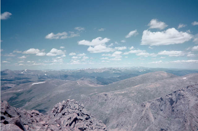
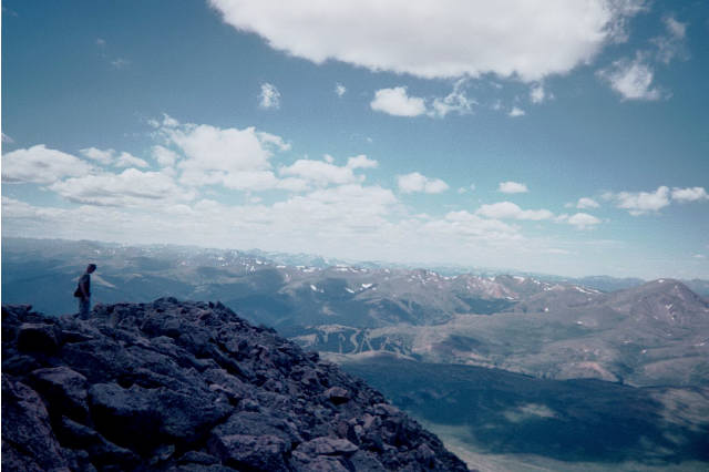
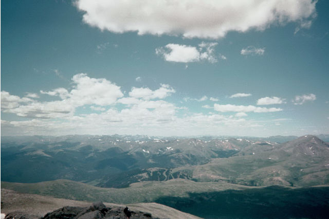
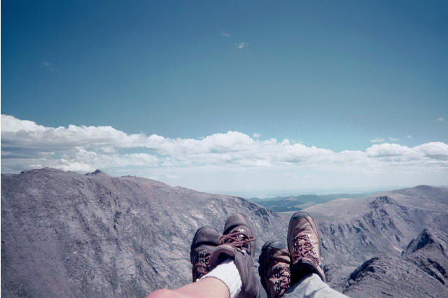
3 miles from whence you began, you reach you goal and find yourself 14,060 feet above sea level with a view of the vast world around you. It s hard to comprehend all that surrounds you as we poke and prod our way through our own little worlds that we have chosen to create for ourselves. Climbing to the highest points gives you a unique prospective. It s hard to believe how much land and grandeur is actually out there until you perch yourself right on top of it all. No other words can describe it other than stating that it is simply amazing! 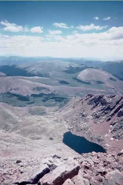
Make your way back the same way as you began. Remember that descent in the very beginning of your hike? Now its an ascent but dont worry. As you approach the parking area, it actually looks a lot worse than it really is. In fact, you hardly feel like you are going up hill at all. Probably because you just climbed a 14er. What a great little trek!
|
  |
|
|
|
|
|
|
|
|
|
| |
 | |  |
|
For more information, drop me an E-mail Unknown Gem Type: tlx.tlx.tellyourfriends | |
|